
SI25 Urban Small Talk: Difference between revisions
No edit summary |
No edit summary |
||
| Line 23: | Line 23: | ||
====Next Steps:==== | ====Next Steps:==== | ||
Scrapped the whole thing, unfortunately. I started from scratch, following this documentation: [https://wiki.openstreetmap.org/wiki/OpenLayers_Simple_Example OpenLayers Simple Example]<br> | Scrapped the whole thing, unfortunately. I started from scratch, following this documentation: [https://wiki.openstreetmap.org/wiki/OpenLayers_Simple_Example OpenLayers Simple Example]<br> | ||
and then moved on to [https://leafletjs.com leafletjs.com] | and then moved on to [https://leafletjs.com leafletjs.com][[File:Screenshot 2024-11-10 214036.png|456x456px|thumb|the map on browser v0000]] | ||
====Latest Version==== | ====Latest Version==== | ||
[[File:Screenshot 2024-11-18 at 10.49.12.png|thumb|456x456px|current layout]] | [[File:Screenshot 2024-11-18 at 10.49.12.png|thumb|456x456px|current layout]] | ||
| Line 34: | Line 32: | ||
=====index.html===== | =====index.html===== | ||
<source lang="html"> | |||
<!DOCTYPE html> | <!DOCTYPE html> | ||
<html lang="en"> | <html lang="en"> | ||
<head> | |||
<title>Urban Small Talk</title> | |||
<link rel="stylesheet" href="style.css"> | |||
<meta charset="UTF-8"> | |||
<meta name="viewport" content="width=device-width, initial-scale=1.0"> | |||
<link rel="stylesheet" href="<nowiki>https://unpkg.com/leaflet@1.9.4/dist/leaflet.css</nowiki>" | |||
integrity="sha256-p4NxAoJBhIIN+hmNHrzRCf9tD/miZyoHS5obTRR9BMY=" crossorigin="" /> | |||
<script src="https://ajax.googleapis.com/ajax/libs/jquery/3.7.1/jquery.min.js"></script> | |||
<script src="<nowiki>https://code.jquery.com/jquery-3.3.1.min.js</nowiki>" | |||
integrity="sha256-FgpCb/KJQlLNfOu91ta32o/NMZxltwRo8QtmkMRdAu8=" crossorigin="anonymous"></script> | |||
<script src="<nowiki>https://cdnjs.cloudflare.com/ajax/libs/PapaParse/5.4.1/papaparse.min.js</nowiki>" | |||
integrity="sha512-dfX5uYVXzyU8+KHqj8bjo7UkOdg18PaOtpa48djpNbZHwExddghZ+ZmzWT06R5v6NSk3ZUfsH6FNEDepLx9hPQ==" | |||
crossorigin="anonymous" referrerpolicy="no-referrer"></script> | |||
<script src="<nowiki>https://unpkg.com/leaflet@1.9.4/dist/leaflet.js</nowiki>" | |||
integrity="sha256-20nQCchB9co0qIjJZRGuk2/Z9VM+kNiyxNV1lvTlZBo=" crossorigin=""></script> | |||
<script src="https://unpkg.com/leaflet@latest/dist/leaflet.js"></script> | |||
<script src="https://unpkg.com/leaflet-providers@latest/leaflet-providers.js"></script> | |||
</head> | |||
<body> | |||
<button id="superbutton" data-dialog="dialogOne">About the project</button> | |||
<!-- info popup --> | <!-- info popup --> | ||
<dialog id="dialogOne"> | |||
<h2>Close your eyes, take a breath… </h2> | |||
<p>The ambience has something to say. <span style="font-size: 1.1em; color:#161616;">Urban Small Talk</span> is a | |||
digital archive of field recordings collected around Rotterdam, offering a new perspective into experiencing the | digital archive of field recordings collected around Rotterdam, offering a new perspective into experiencing the | ||
city. Take a stroll around the soundmap and reconnect with Rotterdam, whether you are a fresh acquaintance or an | city. Take a stroll around the soundmap and reconnect with Rotterdam, whether you are a fresh acquaintance or an | ||
old friend.</p> | old friend.</p> | ||
<p><span style="font-size: 1.1em; color:#161616;">What would happen if Rotterdam heard you?</span> Would the city | |||
change? Would your existence in it change? <span style="font-size: 1.1em; color:#161616;">Does Rotterdam hear | change? Would your existence in it change? <span style="font-size: 1.1em; color:#161616;">Does Rotterdam hear | ||
you?</span> How can you tell? If so, where are you heard? If not, where would you want to be heard?<span | you?</span> How can you tell? If so, where are you heard? If not, where would you want to be heard?<span style="font-size: 1.1em; color:#161616;">If you could speak with Rotterdam,</span> how would the conversation | ||
go? Do you make the city yours by recording it? When has the city recorded you? If you can't communicate with | go? Do you make the city yours by recording it? When has the city recorded you? If you can't communicate with | ||
sound, how else can you? <span style="font-size: 1.1em; color:#161616;">Does Rotterdam understand you?</span> | sound, how else can you? <span style="font-size: 1.1em; color:#161616;">Does Rotterdam understand you?</span> | ||
| Line 76: | Line 74: | ||
Rotterdam?</span> Where do you understand Rotterdam? <span style="font-size: 1.1em; color:#161616;">How do you | Rotterdam?</span> Where do you understand Rotterdam? <span style="font-size: 1.1em; color:#161616;">How do you | ||
defy the city?</span> How does the city defy you?</p> | defy the city?</span> How does the city defy you?</p> | ||
<button class="closeDialog">x</button> | |||
</dialog> | |||
<!-- urban small talk png --> | |||
<div class="pic" onmouseover="document.getElementById('xpub').style.display = 'block';" onmouseleave="document.getElementById('xpub').style.display='none';"> | |||
<img src="resources/pic.png" /> | |||
</div> | |||
<!-- the xpub that appears on hover --> | |||
<div id="xpub"> | |||
<img src="resources/xpub.png"> | |||
</div> | |||
<!-- map div --> | |||
<div id="map"></div> | |||
<script> | |||
// setting the center of the map | |||
var map = L.map('map').setView([51.924444, 4.469444], 13); | |||
L.tileLayer('https://{s}.basemaps.cartocdn.com/dark_all/{z}/{x}/{y}.png', { | |||
minZoom: 11, | |||
maxZoom: 22, | |||
attribution: '© <a href="http://www.openstreetmap.org/copyright">OpenStreetMap</a>' | |||
}).addTo(map); | |||
// Read markers data from data.csv | |||
$.get('data.csv', function (csvString) { | |||
// console.log(csvString); | |||
// Use PapaParse to convert string to array of objects | |||
var data = Papa.parse(csvString, { header: true, dynamicTyping: true }).data; | |||
// For each row in data, create a marker and add it to the map | |||
for (var i in data) { | |||
if (i != 0) { | |||
var row = data[i]; | |||
console.log(row['']); // gets title'' | |||
console.log(row.__parsed_extra) //this is the object data | |||
// code from https://gist.github.com/uafrazier/d589caa322f1b1e7c651 | |||
var customPopup = "<h2> " + row[''] + "''</h2><p>''" + row.__parsed_extra[0] + "''</p>''" + "<nowiki><audio id='player' controls>" + row.__parsed_extra[3] + "<source src='" + row.__parsed_extra[3] + "' type='audio/ogg'>";</nowiki>'' | |||
// specify popup options | |||
var customOptions = | |||
{ | |||
'maxWidth': '250', | |||
'minWidth': '150', | |||
'className': 'custom' | |||
} | } | ||
// making markers, using parsed data for latitude and longitude | |||
var marker = L.marker([row.__parsed_extra[1], row.__parsed_extra[2]], { | |||
opacity: 1, | |||
// this part is for custom marker icon | |||
icon: L.icon({ | |||
iconUrl: 'resources/map.png', | |||
iconSize: [60, 60] | |||
}) | |||
}).bindPopup(customPopup, customOptions).addTo(map); | |||
} | } | ||
}); | } | ||
}); | |||
map.attributionControl.setPrefix( | |||
'View <a href="https://github.com/HandsOnDataViz/leaflet-map-csv" target="_blank">code on GitHub</a>' | |||
); | |||
</script> | |||
<script> | |||
document.querySelectorAll("[data-dialog]").forEach(button => { | |||
button.addEventListener("click", () => { | |||
const dialog = document.querySelector(`#${button.dataset.dialog}`); | |||
dialog.showModal(); | |||
document.body.style.overflow = "hidden"; | |||
document.documentElement.style.overflow = "hidden"; | |||
dialog.querySelector(".closeDialog").addEventListener("click", () => { | |||
dialog.close(); | |||
document.body.style.removeProperty("overflow"); | |||
document.documentElement.style.removeProperty("overflow"); | |||
}) | }) | ||
}) | }) | ||
</script> | }) | ||
</script> | |||
</body> | |||
</html> | </html> | ||
</source> | |||
One of the issues Eleni had was that the code wouldn't work even though she had everything right. It was: | |||
<script src="http://code.jquery.com/jquery-3.3.1.min.js" integrity="sha256-FgpCb/KJQlLNfOu91ta32o/NMZxltwRo8QtmkMRdAu8=" crossorigin="anonymous"></script> | |||
<script src="http://code.jquery.com/jquery-3.3.1.min.js" integrity="sha256-FgpCb/KJQlLNfOu91ta32o/NMZxltwRo8QtmkMRdAu8=" crossorigin="anonymous"></script | |||
that was missing from the head. | that was missing from the head. | ||
Even though the code provided by leafletjs uses row.Latitude[x], Papaparse has a kind of weird way of making Arrays, hence the | Even though the code provided by leafletjs uses row.Latitude[x], Papaparse has a kind of weird way of making Arrays, hence the <code>row.__parsed_extra[x]</code> weird data names. | ||
row.__parsed_extra[x] weird data names. | |||
=====style.css===== | =====style.css===== | ||
<source lang="css"> | |||
@import url('https://fonts.googleapis.com/css2?family=Montaga'); | @import url('https://fonts.googleapis.com/css2?family=Montaga'); | ||
@import url('https://fonts.googleapis.com/css2?family=Syne+Tactile&display=swap'); | @import url('https://fonts.googleapis.com/css2?family=Syne+Tactile&display=swap'); | ||
| Line 293: | Line 294: | ||
cursor:pointer; | cursor:pointer; | ||
} | } | ||
#superbutton{ | #superbutton{ | ||
background-color: transparent; | background-color: transparent; | ||
| Line 338: | Line 339: | ||
background-color:gainsboro; | background-color:gainsboro; | ||
} | } | ||
</source> | |||
=====data.py===== | =====data.py===== | ||
<source lang="python"> | |||
import urllib.request | import urllib.request | ||
import json | import json | ||
| Line 356: | Line 358: | ||
#turning response into clean/pretty html | #turning response into clean/pretty html | ||
soup=BeautifulSoup(text,'html.parser') | soup=BeautifulSoup(text,'html.parser') | ||
#keeping only the <p> elements | #keeping only the <p> elements | ||
csv = ''.join([p.get_text() for p in soup.find_all('p')]) | csv = ''.join([p.get_text() for p in soup.find_all('p')])'' | ||
#cleaning up so that the format is good for csv | #cleaning up so that the format is good for csv | ||
| Line 367: | Line 369: | ||
with open("data.csv", "w") as output: | with open("data.csv", "w") as output: | ||
output.write(csv) | output.write(csv) | ||
</source> | |||
====IRL Map==== | ==== IRL Map==== | ||
Imre and Sevgi are working on the map and how we can make it interesting to collect 'sound related memories' during the event. | Imre and Sevgi are working on the map and how we can make it interesting to collect 'sound related memories' during the event. | ||
| Line 378: | Line 380: | ||
https://commons.wikimedia.org/wiki/File:Plattegrond_van_Rotterdam_in_1940_(2).jpg | https://commons.wikimedia.org/wiki/File:Plattegrond_van_Rotterdam_in_1940_(2).jpg | ||
=== Legend === | ===Legend=== | ||
=====If the city could hear me?===== | =====If the city could hear me?===== | ||
questions; | questions; | ||
* What would happen if Rotterdam heard you? | *What would happen if Rotterdam heard you? | ||
* Would the city change? | *Would the city change? | ||
* Would your existence in it change? | *Would your existence in it change? | ||
* Does Rotterdam hear you? How can you tell? | *Does Rotterdam hear you? How can you tell? | ||
* If so, where are you heard? | * If so, where are you heard? | ||
* If not, where would you want to be heard? | *If not, where would you want to be heard? | ||
* If you could speak with Rotterdam, how would the conversation go? | *If you could speak with Rotterdam, how would the conversation go? | ||
* Do you make the city yours by recording it? | *Do you make the city yours by recording it? | ||
* When have the city recorded you? | * When have the city recorded you? | ||
* If you can't communicate with sound, how else can you? | * If you can't communicate with sound, how else can you? | ||
* Does Rotterdam understand you/Where does Rotterdam understand you? | *Does Rotterdam understand you/Where does Rotterdam understand you? | ||
* Do you understand Rotterdam/Where do you understand Rotterdam? | *Do you understand Rotterdam/Where do you understand Rotterdam? | ||
* How do you defy the city? | *How do you defy the city? | ||
* How does the city defy you? | *How does the city defy you? | ||
Can be connected back to issues of belonging, feeling heard by the city, being used by it, hearing it, using it. Existing in a city is an interactive experience. How have you made the city yours, how did you fail? Have the city made you its own property? Do you feel agency, control over, controlled by? Do you shape how you interact with it, or does the city shape your interactions within it? | Can be connected back to issues of belonging, feeling heard by the city, being used by it, hearing it, using it. Existing in a city is an interactive experience. How have you made the city yours, how did you fail? Have the city made you its own property? Do you feel agency, control over, controlled by? Do you shape how you interact with it, or does the city shape your interactions within it? | ||
| Line 409: | Line 411: | ||
==Event Rider== | ==Event Rider== | ||
===Items=== | ===Items=== | ||
* dreaming of a huge touch screen | *dreaming of a huge touch screen | ||
* A device w internet connection | *A device w internet connection | ||
* a map to pin memories irl, during the expo | *a map to pin memories irl, during the expo | ||
<img src="https://saralana.xyz/assets/posts/palma_na_parede.png" width="400px"> | <img src="https://saralana.xyz/assets/posts/palma_na_parede.png" width="400px"> | ||
| Line 420: | Line 422: | ||
===Space=== | ===Space=== | ||
* 1m x 1m | * 1m x 1m | ||
* Internet Connection | *Internet Connection | ||
* Power outlet for screen | *Power outlet for screen | ||
* Headphones - from XML | *Headphones - from XML | ||
===Time=== | ===Time=== | ||
* Will run asynchronously throughout the event | *Will run asynchronously throughout the event | ||
Revision as of 17:30, 6 January 2025
.png)
Urban Small Talk
Description:
Close your eyes, take a breath… the ambience has something to say. URBAN SMALL TALK is a digital archive of field recordings collected around Rotterdam, offering a new perspective into experiencing the city. Take a stroll around the soundmap and reconnect with Rotterdam, whether you are a fresh acquaintance or an old friend.

Cookbook

Initial Steps taken
- Signed up to UMAP and created a new map
- Customized the map, centered it on Rotterdam
- Created a csv file on cerealbox, where the data would go
- Linked the csv file to the UMAP
- Created HTML page on the cerealbox and embeded the map
Version 1


Next Steps:
Scrapped the whole thing, unfortunately. I started from scratch, following this documentation: OpenLayers Simple Example
and then moved on to leafletjs.com

Latest Version

Eleni used leaflet js library to write a snippet of code and use a .csv file as the database which can be found here: https://pzwiki.wdka.nl/mediadesign/User:Eleni/Special_Issue_25/Soundmap/Data
This is how the code looks like right now:
index.html
<!DOCTYPE html>
<html lang="en">
<head>
<title>Urban Small Talk</title>
<link rel="stylesheet" href="style.css">
<meta charset="UTF-8">
<meta name="viewport" content="width=device-width, initial-scale=1.0">
<link rel="stylesheet" href="<nowiki>https://unpkg.com/leaflet@1.9.4/dist/leaflet.css</nowiki>"
integrity="sha256-p4NxAoJBhIIN+hmNHrzRCf9tD/miZyoHS5obTRR9BMY=" crossorigin="" />
<script src="https://ajax.googleapis.com/ajax/libs/jquery/3.7.1/jquery.min.js"></script>
<script src="<nowiki>https://code.jquery.com/jquery-3.3.1.min.js</nowiki>"
integrity="sha256-FgpCb/KJQlLNfOu91ta32o/NMZxltwRo8QtmkMRdAu8=" crossorigin="anonymous"></script>
<script src="<nowiki>https://cdnjs.cloudflare.com/ajax/libs/PapaParse/5.4.1/papaparse.min.js</nowiki>"
integrity="sha512-dfX5uYVXzyU8+KHqj8bjo7UkOdg18PaOtpa48djpNbZHwExddghZ+ZmzWT06R5v6NSk3ZUfsH6FNEDepLx9hPQ=="
crossorigin="anonymous" referrerpolicy="no-referrer"></script>
<script src="<nowiki>https://unpkg.com/leaflet@1.9.4/dist/leaflet.js</nowiki>"
integrity="sha256-20nQCchB9co0qIjJZRGuk2/Z9VM+kNiyxNV1lvTlZBo=" crossorigin=""></script>
<script src="https://unpkg.com/leaflet@latest/dist/leaflet.js"></script>
<script src="https://unpkg.com/leaflet-providers@latest/leaflet-providers.js"></script>
</head>
<body>
<button id="superbutton" data-dialog="dialogOne">About the project</button>
<!-- info popup -->
<dialog id="dialogOne">
<h2>Close your eyes, take a breath… </h2>
<p>The ambience has something to say. <span style="font-size: 1.1em; color:#161616;">Urban Small Talk</span> is a
digital archive of field recordings collected around Rotterdam, offering a new perspective into experiencing the
city. Take a stroll around the soundmap and reconnect with Rotterdam, whether you are a fresh acquaintance or an
old friend.</p>
<p><span style="font-size: 1.1em; color:#161616;">What would happen if Rotterdam heard you?</span> Would the city
change? Would your existence in it change? <span style="font-size: 1.1em; color:#161616;">Does Rotterdam hear
you?</span> How can you tell? If so, where are you heard? If not, where would you want to be heard?<span style="font-size: 1.1em; color:#161616;">If you could speak with Rotterdam,</span> how would the conversation
go? Do you make the city yours by recording it? When has the city recorded you? If you can't communicate with
sound, how else can you? <span style="font-size: 1.1em; color:#161616;">Does Rotterdam understand you?</span>
Where does Rotterdam understand you? <span style="font-size: 1.1em; color:#161616;">Do you understand
Rotterdam?</span> Where do you understand Rotterdam? <span style="font-size: 1.1em; color:#161616;">How do you
defy the city?</span> How does the city defy you?</p>
<button class="closeDialog">x</button>
</dialog>
<!-- urban small talk png -->
<div class="pic" onmouseover="document.getElementById('xpub').style.display = 'block';" onmouseleave="document.getElementById('xpub').style.display='none';">
<img src="resources/pic.png" />
</div>
<!-- the xpub that appears on hover -->
<div id="xpub">
<img src="resources/xpub.png">
</div>
<!-- map div -->
<div id="map"></div>
<script>
// setting the center of the map
var map = L.map('map').setView([51.924444, 4.469444], 13);
L.tileLayer('https://{s}.basemaps.cartocdn.com/dark_all/{z}/{x}/{y}.png', {
minZoom: 11,
maxZoom: 22,
attribution: '© <a href="http://www.openstreetmap.org/copyright">OpenStreetMap</a>'
}).addTo(map);
// Read markers data from data.csv
$.get('data.csv', function (csvString) {
// console.log(csvString);
// Use PapaParse to convert string to array of objects
var data = Papa.parse(csvString, { header: true, dynamicTyping: true }).data;
// For each row in data, create a marker and add it to the map
for (var i in data) {
if (i != 0) {
var row = data[i];
console.log(row['']); // gets title''
console.log(row.__parsed_extra) //this is the object data
// code from https://gist.github.com/uafrazier/d589caa322f1b1e7c651
var customPopup = "<h2> " + row[''] + "''</h2><p>''" + row.__parsed_extra[0] + "''</p>''" + "<nowiki><audio id='player' controls>" + row.__parsed_extra[3] + "<source src='" + row.__parsed_extra[3] + "' type='audio/ogg'>";</nowiki>''
// specify popup options
var customOptions =
{
'maxWidth': '250',
'minWidth': '150',
'className': 'custom'
}
// making markers, using parsed data for latitude and longitude
var marker = L.marker([row.__parsed_extra[1], row.__parsed_extra[2]], {
opacity: 1,
// this part is for custom marker icon
icon: L.icon({
iconUrl: 'resources/map.png',
iconSize: [60, 60]
})
}).bindPopup(customPopup, customOptions).addTo(map);
}
}
});
map.attributionControl.setPrefix(
'View <a href="https://github.com/HandsOnDataViz/leaflet-map-csv" target="_blank">code on GitHub</a>'
);
</script>
<script>
document.querySelectorAll("[data-dialog]").forEach(button => {
button.addEventListener("click", () => {
const dialog = document.querySelector(`#${button.dataset.dialog}`);
dialog.showModal();
document.body.style.overflow = "hidden";
document.documentElement.style.overflow = "hidden";
dialog.querySelector(".closeDialog").addEventListener("click", () => {
dialog.close();
document.body.style.removeProperty("overflow");
document.documentElement.style.removeProperty("overflow");
})
})
})
</script>
</body>
</html>
One of the issues Eleni had was that the code wouldn't work even though she had everything right. It was:
<script src="http://code.jquery.com/jquery-3.3.1.min.js" integrity="sha256-FgpCb/KJQlLNfOu91ta32o/NMZxltwRo8QtmkMRdAu8=" crossorigin="anonymous"></script>
that was missing from the head.
Even though the code provided by leafletjs uses row.Latitude[x], Papaparse has a kind of weird way of making Arrays, hence the row.__parsed_extra[x] weird data names.
style.css
 @import url('https://fonts.googleapis.com/css2?family=Montaga');
 @import url('https://fonts.googleapis.com/css2?family=Syne+Tactile&display=swap');
 @import url('https://fonts.googleapis.com/css2?family=Syne+Mono&display=swap');
 @import url('https://fonts.googleapis.com/css2?family=VT323&display=swap');

 html, body, #map {
    width: 100%;
    height: 100%;
    margin: 0;
 }

 body{
    background-color:#555555;
    color: rgb(113, 112, 112);
 }

 h2{
    text-transform: capitalize;
    font-family: "VT323", monospace;
    font-weight: 400;
    font-style: normal;
    font-size: 2em;
    line-height: 0.8;
 }

 p{
    font-family: 'Arial', sans-serif;
    font-size: 12px;
    text-align: justify;
    color:rgb(155, 151, 151);
    line-height: 140%;
    font-weight: 100;
 }

 #map{
    opacity: 80%;
    /* filter: grayscale(1) invert(1); */
    /* sepia(40%); */
 }

 .pic{
    opacity: 100%;
    position: absolute;
    z-index: 1;
    left:0.5vh;
    bottom:1vh;
    margin: 3vh;
    transition: filter 0.5s ease;
 }

 .pic img{
    width: 25vw;
    z-index: 2;
 }

 .pic:hover{
    filter: blur(2px);
 }

 #xpub{
    position: absolute;
    bottom: 5vh;
    left: 4.5vw;
    display: none;
    z-index: 3;
 }

 #xpub img{
    width: 15vw;
 }

 #player{
    height:18px;
    width:100%;
    mix-blend-mode:lighten;
 }

 /* popup customization!!!! */
 div.leaflet-popup-content-wrapper, .leaflet-popup-tip {
    font-family: 'Arial', sans-serif;
    font-size: 12px;
    line-height: 1;
    background: rgb(54, 51, 51);
    color: #dcd7d7;
    box-shadow: 0 3px 14px rgba(0,0,0,0.4);
    border-radius: 0;
    /* border:solid 2px #000 ; */
    padding: 1px;
    padding-left: 0px;
    padding-right: 0px;
 }

 div.leaflet-popup-tip{
    background-color:rgb(54, 51, 51);;
 }

 .leaflet-container .leaflet-control-attribution {
    filter: invert();
    opacity: 80%;
    color: #6f6f6f;
 }

 .leaflet-container .leaflet-control-attribution a{
    color: #171717;
 }

 button {
    background:#ffffff;
    height:2vh;
    width:2vh;
    border:0;
    border-radius:3px;
    color:rgb(54, 51, 51);
    padding:0 10px;
    cursor:pointer;
 }

 #superbutton{
    background-color: transparent;
    color: #f1f0f0;
    font-family:"vt323";
    font-size: 18px;
    text-decoration: underline;
    position:absolute;
    bottom:30px;
    left: 0;
    right: 0;
    margin: auto;
    width:400px;
    height: 30px;
    z-index: 1000;
    transition: filter 0.2s;
 }

 #superbutton:hover{
    filter: blur(3px);
 }

 dialog{
    width:20vw;
    max-height:60vh;
    padding:0px 20px 20px 20px;
    box-shadow:0 0 10px rgba(0,0,0,0.2);
    border: solid 1px rgb(54, 51, 51);;
    border-radius:3px;
    position:relative;
 }

 dialog button{
    position:absolute;
    top:20px;
    right:20px;
    /* padding: 5px; */
    /* background:rgb(54, 51, 51);; */
    color:rgb(54, 51, 51);
    border: 0px;
 }

 ::selection{
    background-color:gainsboro;
 }
data.py
 import urllib.request
 import json
 from bs4 import BeautifulSoup

 # wiki api call
 url = "https://pzwiki.wdka.nl/mw-mediadesign/api.php?action=parse&page=User:Eleni/Special_Issue_25/Soundmap/Data&format=json"

 response = urllib.request.urlopen(url).read()

 data = json.loads(response)

 #cleaning up the json response
 text = data["parse"]["text"]["*"]

 #turning response into clean/pretty html
 soup=BeautifulSoup(text,'html.parser')

 #keeping only the <p> elements
 csv = ''.join([p.get_text() for p in soup.find_all('p')])''

 #cleaning up so that the format is good for csv
 csv = csv.replace("\n\n","\n")
 csv = csv.replace("  ","")
 csv = csv.replace(", ",",")

 with open("data.csv", "w") as output:
    output.write(csv)
IRL Map
Imre and Sevgi are working on the map and how we can make it interesting to collect 'sound related memories' during the event.
We are thinking about the physical map, maybe we can use legends as a way to guide the audience into adding their memories to the map.
<img src=" " height="400px">
https://rotterdamkaart.nl/kaart-1936/
https://commons.wikimedia.org/wiki/File:Plattegrond_van_Rotterdam_in_1940_(2).jpg
.jpg)
Legend
If the city could hear me?
questions;
- What would happen if Rotterdam heard you?
- Would the city change?
- Would your existence in it change?
- Does Rotterdam hear you? How can you tell?
- If so, where are you heard?
- If not, where would you want to be heard?
- If you could speak with Rotterdam, how would the conversation go?
- Do you make the city yours by recording it?
- When have the city recorded you?
- If you can't communicate with sound, how else can you?
- Does Rotterdam understand you/Where does Rotterdam understand you?
- Do you understand Rotterdam/Where do you understand Rotterdam?
- How do you defy the city?
- How does the city defy you?
Can be connected back to issues of belonging, feeling heard by the city, being used by it, hearing it, using it. Existing in a city is an interactive experience. How have you made the city yours, how did you fail? Have the city made you its own property? Do you feel agency, control over, controlled by? Do you shape how you interact with it, or does the city shape your interactions within it? Can be further tied to mobility, can you move around Rotterdam, do you let the city move within you? Are you yourself in Rotterdam, where exactly, which version of yourself are you? How did you let the city change you?
Refs and resources
Protocols for Collective Performance: Radio Broadcast 2
Radio Aporee
Leaflet
Leaflet Maps with CSV
DIY Soundmap : https://saralana.xyz/sound-map
Event Rider
Items
- dreaming of a huge touch screen
- A device w internet connection
- a map to pin memories irl, during the expo
<img src="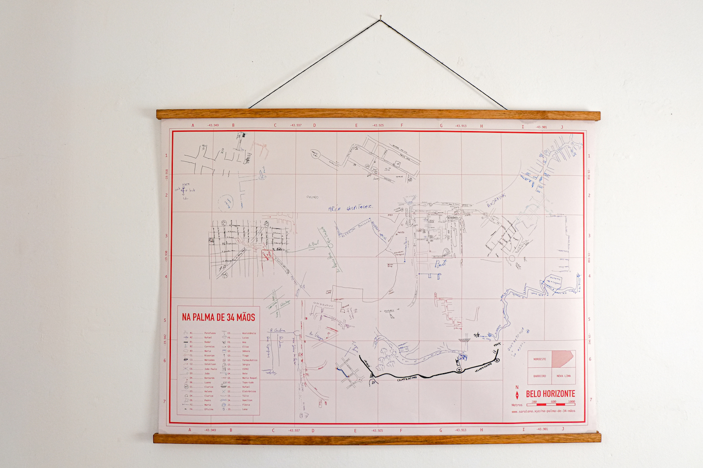 " width="400px">
legend: stays rest of the map: skeleton of Rotterdam, laid over cork? buy pins
Space
- 1m x 1m
- Internet Connection
- Power outlet for screen
- Headphones - from XML
Time
- Will run asynchronously throughout the event